

Home | Maps
Maps
Warrick Trails is a donor-supported trail system that connects neighborhoods, schools, parks and retail establishments throughout Warrick County, offering a unique and desirable lifestyle amenity to both residents and businesses alike.
TRAILHEADS:
Deaconess Trailhead
Upgrade Trailhead
Nevins Trailhead
Ascension-Aurand Trailhead
Prime Foods Trailhead
IMCU Trailhead
TRAILS:
Old National Bank Loop
Victoria Woods Trail
Amax Trail
Rivertown Trail
Wellness Trail
High Pointe Trail
Lynnville Trail


Toyota Trailhead
Amenities:
-
Parking
-
Picnic tables
-
Shade structure
-
Benches
Trail Connections:
-
Castle S. Middle School: 0.5 miles
-
Deaconess Trailhead: 2.5 miles
-
Friedman Park: 3.3 miles
-
Upgrade Trailhead (Vann Park): 2.3 miles
-
Nevins Trailhead: 2.5 miles
Description:
Toyota has generously sponsored the trailhead at Hwy 261, conveniently located next to Castle High School. This trailhead serves as a vital connector within the Warrick Trails system, linking Castle High School to Castle South Middle School, the Deaconess Trailhead, the Upgrade Trailhead at Vann Park, Amax Fields, and Friedman Park.
With Toyota’s support, the community benefits from safe and accessible connections to schools, parks, sports complexes, and neighborhoods. The trailhead provides convenient access for walkers, runners, and cyclists, ensuring residents and visitors can enjoy the many recreational opportunities throughout the area.

Deaconess Trailhead
Deaconess has sponsored the Trailhead at Anderson Rd. This trailhead serves as a vital connector between various trails in the area, and serves the the start for the Old National Bank Loop. This is a great place to park to easily get to Friedman Park (1/2 mile) and can also access the following places by trail: Upgrade Trailhead (Vann Park), Castle High School to Castle South Middle School, and Amax Fields. We are grateful of Deaconess' support of trails for the betterment of our community.

Deaconess Trailhead
Amenities:
-
Parking
-
Water fountain
-
Bike loops
-
Bike air pump station
-
Picnic tables
-
Shade structure
Trail Connections:
-
Friedman Park: 0.8 miles
-
Victoria Woods Trail: 2.0 miles
-
Upgrade Trailhead (Vann Park): 1.8 miles
-
Nevins Trailhead: 2.0 miles
-
Toyota Trailhead: 2.5 miles
Description:
Deaconess proudly sponsored the trailhead located on Anderson Road, a central hub within the Warrick Trails system. This trailhead plays a key role in connecting multiple trail segments and serves as the starting point for the Old National Bank Loop, a popular route for walkers, runners, and cyclists.
Deaconess Trailhead offers convenient access to Friedman Park, located just 0.8 miles away, and connects to several key destinations, including the Upgrade Trailhead at Vann Park, Castle High School to Castle South Middle School, and Amax Fields via paved trail.
We are grateful for Deaconess' investment in community health and wellness through their support of this vital connector in the Warrick Trails system.

ONB Loop
Trail Connections:
-
Friedman Park: 0.8 miles
-
Victoria Woods Trail: 2.0 miles
-
Upgrade Trailhead (Vann Park): 1.8 miles
-
Nevins Trailhead: 2.0 miles
-
Toyota Trailhead: 2.5 miles
Description:
The Old National Bank Loop is a 4.75-mile paved trail loop that begins and ends at the Deaconess Trailhead on Anderson Road. This well-connected, multi-use loop is a favorite among walkers, runners, and cyclists for both recreation and commuting, and it showcases some of the most scenic and active areas of the Warrick Trails system.
Starting at Deaconess Trailhead, the loop travels 0.8 miles to Friedman Park, then continues along a dedicated path on Roslin Road. At approximately 1.4 miles in, trail users will find a spur leading to the Victoria Woods Trail, which includes a picturesque bridge crossing surrounded by natural beauty. From there, the loop connects down Vann Road, providing direct access to Vann Sports Park (Upgrade Trailhead) before circling back to complete the loop at Deaconess.
In addition to its primary route, the Old National Bank Loop offers connections to several key destinations via spur trails, including:
-
Victoria Woods Trail
-
Amax Trail and Nevins Trailhead @ Amax Fields
-
Castle High School / Toyota Trailhead
-
Castle South Middle School
Thanks to the generous support of Old National Bank, this loop serves as a cornerstone of connectivity in Warrick County, promoting healthy lifestyles and active transportation for all ages.

Upgrade Trailhead
Amenities:
-
Parking
-
1/2 Mile Trail Loop
-
Bike loops
-
Picnic tables
-
Benches
-
Shade structure
Trail Connections:
-
Friedman Park: 2.5 miles
-
Victoria Woods Trail: 1.5 miles
-
Deaconess Trailhead: 1.8 miles
-
Nevins Trailhead: 1.8 miles
-
Toyota Trailhead: 2.3 miles
Description:
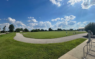
The Upgrade Foundation sponsored the Trailhead at Vann Sports Park, which serves as a vital connector within the trail system. There was also 1/2 mile loop added around a scenic lake at this location. The Trailhead provides convenient parking options and offers visitors the opportunity to enjoy a leisurely walk around the lake or utilize the trail connection to access other locations, including Friedman Park, the Deaconess Trailhead, Amax Fields, the Toyota Trailhead, Castle High School, and Castle South Middle School. We extend our heartfelt gratitude to Upgrade for their invaluable support, which has enabled Warrick Trails to create and promote opportunities that facilitate healthy living through easy access to trails for our community.

Vann Rd Trail
Information:
-
3.1 mile trail on Vann Rd between Wethers Rd & Castle High School
Description:
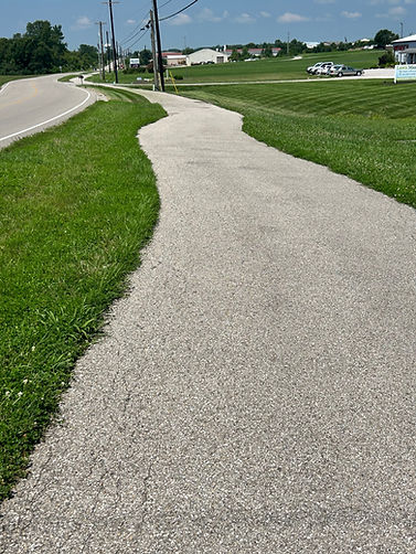
The Vann Rd Trail is a 3.1-mile asphalt path that runs from Wethers Road to Castle High School, following Vann Road. At 8 feet wide, the trail is designed for walkers, runners, cyclists, and strollers, offering a safe and versatile route through the community.
The trail features a mix of flat stretches and a few longer incline hills, making it an enjoyable option for both casual outings and more challenging workouts. It can be accessed from the Upgrade Trailhead and Toyota Trailhead, both with convenient parking.
Along the way, the Vann Rd Trail connects directly to Castle High School and Vann Rd Park, with side trails leading to Friedman Park and Amax Fields. This makes it a key link in the Warrick Trails system, tying together schools, neighborhoods, parks, and recreational destinations.
As one of the longest continuous routes in the network, the Vann Rd Trail is both a community connector and a welcoming option for visitors exploring Warrick County.
Nevins Trailhead
Coming Spring 2024
View trailhead

Nevins Trailhead
Amenities:
-
Parking
-
Water fountain
-
Bike loops
-
Bike air pump station
-
Picnic tables
-
Shade structure
Trail Connections:
-
Friedman Park - 2.8 miles
-
Deaconess Trailhead - 2.0 miles
-
Upgrade Trailhead - 1.8 miles
-
Vann Sports Park - 1.8 miles
-
Toyota Trailhead - 2.5 miles
Description:
Nevins Trailhead serves as a key access point to the Warrick Trails system, offering trail users a well-equipped and centrally located starting hub. Positioned at the corner of Lincoln Avenue and Anderson Road, Nevins Trailhead is the entrance point to Amax Fields, Warrick County’s largest soccer and football complex. The trailhead connects to the Amax Trail, a 1-mile paved path that links to the broader regional trail network.
Thanks to a Readi 2.0 grant, this trailhead is named in memory and honor of Howard Nevins, the founder of Warrick Trails, this trailhead celebrates his vision of connecting communities and encouraging healthy, active lifestyles. With shaded seating, family-friendly features, and multiple trail connections, Nevins Trailhead is a high-traffic access point for walkers, runners, bikers, and sports spectators.

Amax Trail
-
1 mile Trail on Anderson Rd between Outer Lincoln Ave and Vann Road
Description:
The Amax Trail is a beautiful 1-mile stretch that runs along Anderson Road, connecting Outer Lincoln Avenue to Vann Road. This paved path links the Nevins Trailhead and Amax Fields to the larger Warrick Trails system, offering a safe and scenic route for walkers, runners, and cyclists.
Constructed with support from Indiana’s Next Level Trails grant program, the Amax Trail enhances community connectivity and provides direct access to nearby parks, sports complexes, and additional trailheads throughout the area.
Whether you're heading to practice, out for a bike ride, or enjoying a peaceful stroll, the Amax Trail is a key connector in the heart of Warrick County’s trail network.

Victoria Woods Trail
Trail Connections (from start of trail at Roslin Rd):
-
Friedman Park: 0.6 miles
-
Baker Rd: 1.7 miles
-
Upgrade Trailhead (Vann Park): 1.5 miles
-
Nevins Trailhead: 3.2 miles
-
Toyota Trailhead: 3.8 miles
Description:
Through the help of Warrick County and the Readi grant, Warrick Trails could build the Victoria Woods Trail, a 1.7-mile paved path that winds through the scenic Victoria Woods subdivision, offering a quiet and beautiful route for walkers, runners, and cyclists. Beginning off Roslin Road at the Old National Bank Loop, the trail crosses a picturesque bridge and continues through tree-lined neighborhoods before ending at Baker Road.
From the Roslin Road entrance, it’s just 0.6 miles to Friedman Park, giving trail users easy access to one of Warrick County’s most popular destinations. Fully paved and 8 feet wide, the trail is bike- and stroller-friendly, making it a safe and enjoyable option for families and fitness enthusiasts alike.
As part of the larger Warrick Trails system, the Victoria Woods Trail combines natural scenery with community connectivity, linking neighborhoods to parks and recreational spaces.

Ascension-Aurand Trailhead
Amenities:
-
Parking
-
Water fountain
-
Bike loops
-
Public Restrooms
-
Picnic tables
-
Shade structure
Trail Connections:
-
Mulzer Ballfields: 0.6 miles
-
Newburgh Library: 0.7 miles
-
Old Lock & Dam: 1.0 mile
-
New Lock & Dam: 2.8 miles
Description:
Thanks to the generous support of Ascension St. Vincent, the Aurand Trailhead—nestled in the heart of Downtown Newburgh—has been thoughtfully revitalized into a welcoming and accessible hub for trail users and visitors alike. The renovation included the addition of convenient parking, attractive seating areas, and landscaping improvements, transforming it into both a community gathering point and a gateway to outdoor recreation.
The Aurand Trailhead serves as a key access point to the Rivertown Trail, a 3-mile paved path that runs along the scenic Ohio River. This trail offers breathtaking views of the waterway, passing by historic landmarks, charming riverfront homes, and vibrant parks. It’s perfect for walking, running, biking, or simply enjoying the beauty of Newburgh’s historic downtown.
With easy access to local shops, restaurants, and parks, Aurand Trailhead is a great place to start your day outdoors—whether you're exploring the trail, visiting the Newburgh Library, heading to a ballgame at Mulzer Field, or catching a sunset at the Old Lock & Dam overlook.
Ascension St. Vincent’s commitment to the health and wellness of our community made this revitalization possible, ensuring that this scenic and historic part of Warrick County continues to thrive for generations to come.

Prime Foods Trailhead
Amenities:
-
Parking
-
Water fountain
-
Bike loops
-
Picnic tables
-
Shade structure
-
Walking Loop
Workout:
-
0.12 mile loop
-
Box Jumps
-
Sit-Ups
-
Pull-Ups/Dips
-
Push-Ups
Description:
Prime Foods has generously sponsored a trailhead within the Boonville Industrial Park. This trailhead features a 0.12 mile track loop adorned with four fitness stations, offering a comprehensive workout experience that includes activities such as box jumps, pull-up/dip bars, push-up bars, and a sit-up station.
The addition of parking facilities and a scenic shelter equipped with picnic tables further enhances the appeal of this area. Prime Foods also takes on the responsibility of maintaining this invaluable trailhead, which remains a true gem in the community.


Lynnville Trail
Trail Connections:
-
From East Side Trail Parking Lot:
-
Coal Museum: 0.8 miles
-
Lynnville Park: 1.25 miles
-
Tecumseh HS: 2.1 miles
-
-
From West THS Parking Lot:
-
Lynnville Park: 0.8 miles
-
Coal Museum: 1.5 miles
-
East Parking Lot: 2.1 milesmiles
-
Description:
The Lynnville Trail is a 2.1-mile paved asphalt path that connects the Lynnville Community Center, Lynnville Coal Museum, Lynnville Park, and Tecumseh High School. It is a beautiful 8 foot wide trail that provides a safe and accessible route for students, families, and community members.
Parking is available at both ends of the trail, making it easy for visitors to access. Students can safely walk or ride to school, while the community can enjoy direct connections to Lynnville Park’s recreational amenities.
With its tree-lined stretches and open views, the Lynnville Trail is often considered one of the most picturesque trails in the tri-state area. Perfect for walking, running, or cycling, it offers both residents and visitors a safe, enjoyable, and scenic way to stay active outdoors.

IMCU Trailhead
Amenities:
-
Parking
-
Bike loops
-
Benches
-
Water Fountain
Trail Connections:
-
Ohio Township Park: 0.5 miles
-
Sports Complex: 2.0 miles
-
Friedman Park: 6.1 mile (via sidewalk and trails)
Description:
The Indiana Members Credit Union sponsored the IMCU Trailhead is located at the Newburgh branch parking lot. With this partnership, a covered bench area, water fountain and bike rack area that connects to the 1/2 mile High Point Trail along High Point Dr. connecting the bank to restaurants, apartments and shopping centers.


High Pointe Trail
Trail Connections:
-
Ohio Township Park: 0.5 miles
-
Sports Complex: 2.1 miles
-
Friedman Park: 6.1 mile (via sidewalk and trails)
Description:
The High Pointe Trail is a 0.6-mile paved asphalt path that runs along High Pointe Drive, connecting Libbert Road to Bell Road. At 8 feet wide, the trail is bike- and stroller-friendly, providing a safe and accessible route for walkers, runners, and cyclists.
This trail enhances community connectivity by linking nearby apartments, multiple restaurants, Walmart, and office buildings, making it a convenient option for both recreation and everyday errands. It also connects to the IMCU Trailhead, which offers parking, water, benches, and bike loops, providing a comfortable starting or resting point for trail users.
Whether heading out for exercise, a short walk, or a quick bike ride, the High Pointe Trail offers a safe, accessible, and scenic route through this part of the community.

Wellness Trail
Amenities:
-
West End (Epworth Rd)
-
Parking @ Ascension
-
-
Benches along trail
Trail Connections:
-
West End:
-
Sports Complex: 0.5 miles
-
Ohio Township Park: 1.75 miles
-
IMCU Trailhead: 1.6 miles
-
Friedman Park: 7.7 miles (via sidewalk and trails)
-
-
East End:
-
Sports Complex: 1.9 miles
-
Ohio Township Park: 0.35 miles
-
IMCU Trailhead: 0.1 miles
-
Friedman Park: 6.2 miles (via sidewalk and trails)
-
Description:
The Wellness Corridor Trail is a 1.5-mile paved asphalt path running through the heart of the region’s wellness corridor, beginning off Epworth Road. At 8 feet wide, it is bike- and stroller-friendly, providing a safe and accessible route for walkers, runners, and cyclists.
This trail connects multiple healthcare facilities, hotels, apartments, and restaurants, making it both a recreational and practical route for the community. It links directly to the High Pointe Trail and is just 0.5 miles from the new Ohio Township Park, offering easy access to additional recreational opportunities.
Whether for exercise, commuting, or a leisurely stroll, the Wellness Corridor Trail provides a safe, scenic, and convenient pathway through one of the area’s most active and connected neighborhoods.

Rivertown Trail
Trail Connections:
-
From New Locks & Dam
-
Old Lock & Dam: 1.7 miles
-
Downtown Newburgh Library: 2.1 miles
-
Ascension- Aurand : 2.8 miles
-
Mulzer Fields: 3.4 miles
-
Description:
The Rivertown Trail is a 3.4-mile multi-use greenway that runs from Mulzer ballfields to the new Locks & Dam Park along the Ohio River Scenic Byway. Winding through the heart of downtown Newburgh, the trail provides access to restaurants, coffee shops, and a farmers’ market on Saturdays, making it both a recreational and community-focused route.
The trail features trailheads, interpretive signage, and attractive landscaping, creating a welcoming and scenic environment for walkers, runners, and cyclists. Its location along the riverfront offers picturesque views and easy connections to downtown amenities, making the Rivertown Trail a central and enjoyable part of the Warrick Trails system.